Tuesday, June 30, 2015

Tuesday, June 30 - Day 14: Leaving Yosemite and Heading Towards Death Valley

I have a few more photos I took at Yosemite this morning on my ride out of the park. In the first photo, the large tree behind the motorcycle is as wide as my arm span is.  It may not be as large as some of the Giant Redwoods along the coast but still an impressive tree no less.


My plan for the day was to get close to Death Valley and get a hotel room due to the expected heat.  I stopped at Lone Pine.  Along the way, I got some more great views of the Sierra Nevada Mountains.


Well, the heat is really start to build all over the west region. Temperatures are 15 - 25 degrees above average - I didn't plan for that.  I have been able to avoid it so far mostly by staying at higher altitudes.  Now I can no longer escape it.  I stopped and purchased a CamelBak which is a small backpack to store liquids in and a hose to drink from it.  This will enable me to drink and keep hydrated while riding rather than having to stop and drink which is when you get really hot!

The other benefit of getting a hotel today (beside the fact that camping in 100+ degrees just isn't fun) is that I can reevaluate the remaining part of my trip and determine the best way to start heading home.  I have already decided to skip Hoover Dam.  It is going to be 106 in Vegas tomorrow.  Basically my plan will be getting up early and riding each day as long as I can and then get a motel room, at least until I reach more moderate temperatures again. Now I just need to figure out the route.

I have one other piece of information I forgot to include during my equipment update.  I have a free app on my phone called Bubbler GPS Lite.  There is also a Pro version that costs about $10.  What this app does is basically checks you location every so often  (I have mine set to 30 minutes) and it uses the GPS location from the phone and sends it to a website.  If you don't have cell phone reception at that time, it will store the information and send it when you have service.  Followers can then look at the website to see where you are.  I set this up so Cathy has a better idea of where I am on these trips.  

This model is very similar to the SPOT devices you can buy and pay an annual fee for.  The difference is that the SPOT devices use satellites to send data so they work in more places.  With SPOT, you can also press a button to indicate an emergency and help will be dispatched.

Both the Bubbler GPS Lite app I have and the SPOT devices uses the website SPOTWALLA.com to set up the information and allow people to track your trips.  I have only shared with Cathy how to follow me on this trip as others don't need that much information.  Below is sample from the website.  You can see through Idaho and Oregon, the coverage was not very good, I am not sure why.  The large gap from Oregon to California was operator error (me).  I turned off my phone at night because I didn't have reception and thought I would save the battery.  What I forgot to do was start the app in the morning.  Now I am leaving my phone on all the time.

I am sharing this information as others may find a use for this technology as well.  Works pretty well for the price!


Here are a few other pieces of information:

  • I have put on 6,137 miles so far.
  • I am averaging 463 miles per day
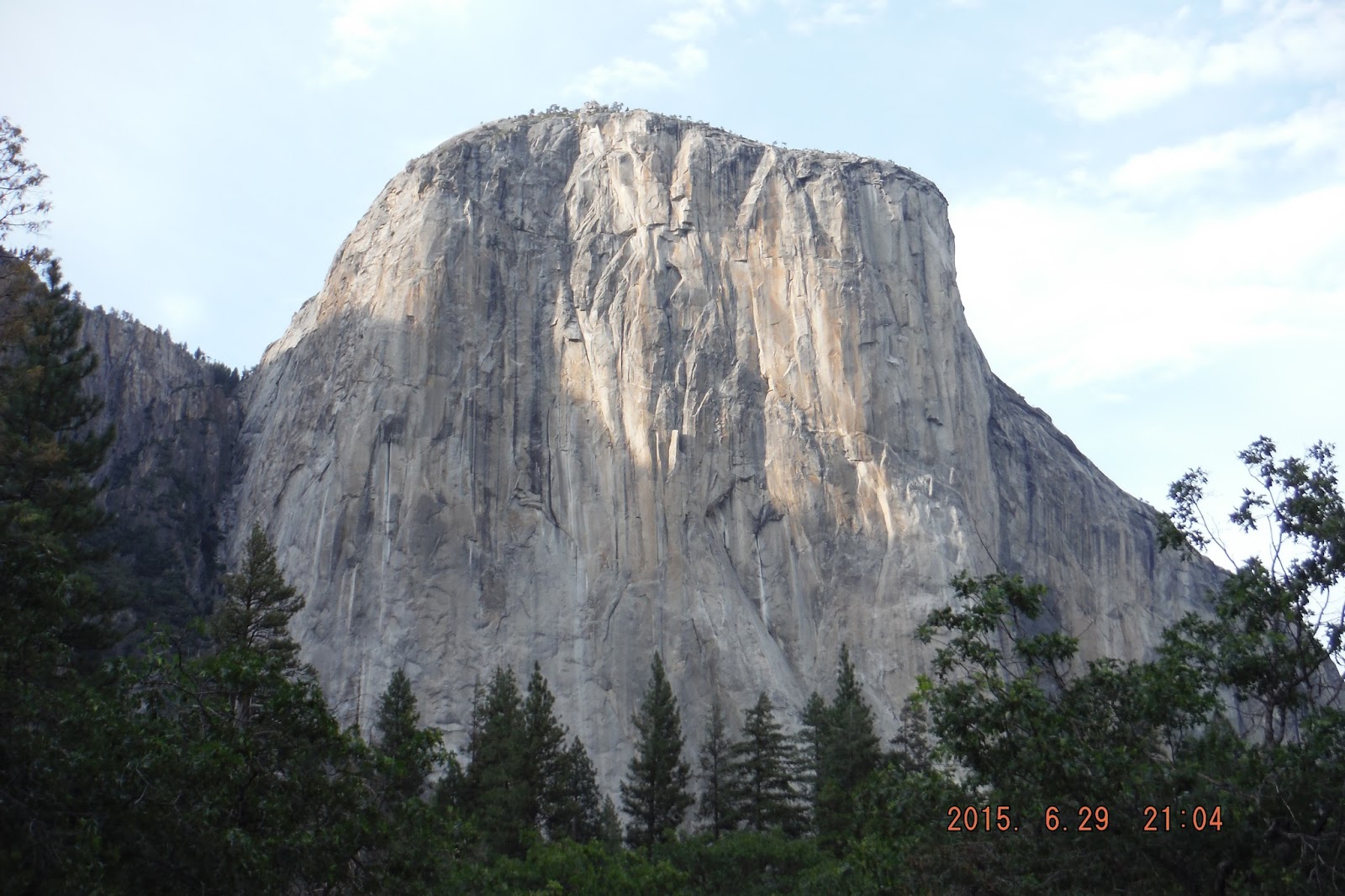
    • Yesterday going through Yosemite I only did 287 miles
    • Today as I stopped before Death Valley, I did only 188 miles 
    • Prior to the last 2 days, I averaged 503 miles per day

Monday, June 29: Sonora Pass, Yosemite, and a Couple of Goat Paths! - Day 13

Yesterday I did 3 passes over the Sierra Nevada Mountains.  I found out this morning that I had saved the best to last!  I went over Sonora Pass, which is over 9,000 feet, and it provided the best views.  When I am riding, some roads you want to do a “sporty” ride and enjoy the road.  Other roads you want to take it easy and enjoy the views.  Senora Pass is one to enjoy the views.  They were breath taking.  One this pass, as well as one yesterday, I encountered road signs saying 26% grade.  I don’t believe I have ever seen this sharp of grade on a public road before.  Now I have seen it two days in a row.  Going down a 26% grade and doing tight hair-pin turns at the same time will test your riding abilities.  It feels like you are almost standing on your head while turning.  That is how they get you from 9,000 feet to 5,000 feet very quickly.  What a blast!


The next highlight was Yosemite.  As I said previously, this was my first visit to Yosemite.  The centerpiece of Yosemite is a rock called “Half Dome”. It is a large dome rock that half of it fell away.  You get to see Half Dome from several different angles.  Typically, Yosemite is also known for its waterfalls.  With the drought conditions California has been having for several years, the falls were either pretty small or nonexistent.  I have included a couple of waterfall photos, the first is Bridal Falls (which has very little water coming over it); the other one is of larger falls but you were unable to get any closer to them.


And now for the goat paths!  The first one was when I was going between Senora Pass and Yosemite.  Somehow my Garmin GPS put me on this backroad that was really more like a goat path going down one side of the mountain, across a river, and back up the other side.  This was a single lane road. There was no place to turn around.  How Garmin determined this was the fastest route, I will never know!  The road name had something to do with a ferry so I was concerned I was actually going to have to take a ferry across the river, but about half way down the mountain, I did see the bridge so at least that fear was relieved.  When I approached the bridge, my next concern was that Billy Goat Gruff was going to not let me pass across his bridge without paying him; but again this did not happen either.  However, it looks the bridge is used as a large graffiti space more than anything else.  Almost the entire bridge was covered.

The second goat path was back to my campsite for this evening which is in Yosemite National Park.  The road to the campsite is again single lane.  It had been paved once but in many places the asphalt has been broken up and/or filled with pot holes.  Some holes have filled in with sand.  Some placed crushed rock was used.  I had no idea how far down this road the campsite was.  It didn’t look THAT far on the map.  Well it turns out, it is exactly 5 miles in the goat path, which took me 23 minutes. It turns out though, that the campsite is wonderful!  I am right next to a babbling creek (Yosemite Creek).  This is by far the best campsite of the trip and it was also the cheapest at only $10  No worry about live music concerts or freeways at this campsite.  While many of the other campgrounds are full, there are a lot of empty spaces here.  I think most people are afraid to come this far back.  I actually had a pick-up pull over as I was coming in the first time and he let me pass him; I could go faster than a pick-up – go figure.  The trick to riding roads like this is to stay loose, stay relaxed, picked your smoothest line, and just take your time.  The reward is at the end of the goat path!


Tomorrow I am going to do another look through a different part of Yosemite and then head towards Death Valley.  My plan is to get a place near there to spend the night and then go through the park early in the morning before it gets too hot.  We will see how well this all works out.

Here are some photos from Yosemite.


Here is today's route.

Monday, June 29, 2015

Sunday, June 28, Day 12: Traffic Day

Today's route brought me across the Sierra Nevada Mountains 3 times plus around Lake Tahoe.  This is my first time riding in this area. Here is route ((dark line on the map).


As this is my first time riding in the Sierra Nevada Mountains, I quickly noticed how rocky they are.  Each mountain range seems to have its own distinct characteristics.  Here are a couple of photos showing what I mean.


One other thing I saw in the Sierra Nevada Mountains and I have also seen other places on this trip is what is called a "flag tree".  The flag tree is not a specific type of tree but rather how it grows.  Due to harsh wind and weather in certain areas, all the branches on the tree only grow (or survive) on the sheltered side of the tree.  


I also stopped for some photos at Lake Tahoe.  Here are a few snaps. There was a bunch of haze in the air so these are the best photos I could get unfortunately.


After Lake Tahoe is when the traffic "issues" started.  First it took me over 1 hour to go around the south end of Lake Tahoe.  It was noon on Sunday and people were heading out of town after the weekend.  There is also a "check" station as you enter California that was slowing things up.

The next traffic situation was near the end of the day as I was finishing my last pass over the mountains.  One of the roads I wanted to take was closed due to a fire.  I could not see any fire or smoke but the smell of smoke hung in the air.  I did see a helicopter carrying a bag of water so there must have been some active fire somewhere.  I did drive through a large section you could tell had recently been on fire.  With the road closure, there is no "short" detour when in the mountains.  I had to detour from California back into Nevada and then get back on route. Oh well.

The third traffic incident occurred about 25 miles from my intended campsite.  This was on a major road and there had been a terrible crash.  We were stopped for a long period of time or at times they would let 1 side of traffic or the other proceed.  It took another 1.5 hours to get through this traffic congestion.  It appears a pickup towing a camper trailer (maybe 30 feet long) crashed with another vehicle.  All that was left of the trailer was the frame and a pile of debris.  The other car involved in the incident did not look very good, the entire front end was smashed back to the front seat.  I did see a medical helicopter leave the scene.

I am spending the night at the Coleville California KOA.  It is time to do laundry and get caught up.  I was hoping to get here early but that didn't happen.  It was almost 7:00PM by the time I arrived.  This is a pretty nice KOA.  It has the nicest bathrooms I have seen in a KOA. It is not very busy either. Nice and quiet and with a view as well.


Well, it is almost 8:00 a.m. Monday morning I have still have to pack up before I get going today so I best get moving.  The route today will bring me over the mountains 1 more time and then to Yosemite National Park.  Another first for me.

Saturday, 27th of June – Day 11

First, if people are wondering why the blog isn't updated every day, it is because I have often camped "off the grid" at locations where there is no WiFi or cell phone service.  I still write the blog each night, but I have to find a location where I can get some sort of service to do the upload.

I left the campground this morning and headed south along the Pacific Coast.    The next image is to make all the motorcycle riders reading this blog jealous!  This was the first road I got to ride this morning.  Just one of many like it again today!  I liked it so much I turned around and did it again!  Unfortunately the second time wasn’t as much as the first time.  The first time, the other drivers were courteous and when you came up behind them, they pulled over as they are supposed to do.  It is posted all along the roads.  The second time, I guess people didn’t feel this was important so I got stuck in a row of 7 vehicles at one time.  Oh well, at least the first time was a blast! 


Once back on the coast I again headed south.  This time when I turned left (east) it was time to put the Pacific Ocean in my mirrors for the last time on this trip.  It was time to head east to the Sierra Nevada Mountains.  Along the way, I passed through several valleys where fruit and vegetables are grown.  Peaches, grapes, tomatoes, and sunflowers were popular crops.  There were others I did not recognize.  It is good thing I am a  connoisseur of good roads and not wines.  With all the wine tasting that was available, I would not have made it very far today!


Once again it got a little warm this afternoon but I was better prepared this time. For 2 – 3 hours, the temperature was between 95 and 98 degrees.  Today I had my Heat-Out shirt on.  I bought this shirt last year in Phoenix AFTER driving 1.5 hours in 107 degree temperatures.  I remembered to put it on this morning as my first layer.  I then had my long sleeve t-shirt on and then my jack liner which was covered by my mesh jacket.  Yes, 4 layers.  It was a cool 55 degrees by the ocean this morning.  As the temperatures went up, the layers came off.  I must say I was pretty impressed with the Heat-Out shirt.  It is a tight fitting, stretch, moisture wicking shirt.  It helps keep you dry and also provided good cooling under my mesh jacket.  Yes, even in these temperatures I keep all my safety gear on: helmet, gloves, jacket, boots, riding pants.  My experience is these all keep the beating sun off your skin and thus help keep you cool; at least while you are moving.  Everyone needs to determine which gear is best for them, but rule number 1 is, "if you don't wear it, it doesn't do any good!"

I am spending the night at a National Forest campground near (40 miles away from) Nevada City California (confusing right!)

Sometime during my blog I usually talk about “equipment” so I will do that tonight.  The most obvious piece of new “equipment” I have on this trip is the new motorcycle.  It is a 2014 Candy Apple Red Yamaha FJR 1300 ES.

This is the same model of bike I had before, just much newer.  The previous one was a 2006 and had almost 94,000 miles on it when I sold it this spring.  Some of the big differences with this bike are all the electronics that have been added.  Here is a partial list: cruise control, heated grips, traction control, 2 drive modes (touring and sport – I like sport!), and electronic suspension.  I have not had to use the heated grips on this trip thankfully.   The cruise control is really nice to have on a trip like this.  I had it when I had my previous 2 Goldwings but did not have on the previous FJR.  I really like having the electronic suspension as well.  I am changing the settings more than I thought I would.  You can set the suspension for the number of people riding as well as how hard or soft you want the ride to be.  For example, when I went to ZARS (advanced riding school) at the beginning of June, I set the suspension to 1 up riding and hard.  When I commute to work, I use 1 person plus luggage and a soft setting.  For this trip, I have it set for 2 people (because of the weight of my luggage) and when I am cruising along, I have it for a soft ride, when I am in the twisties, I set it to Standard ride.  It all seems to be working very well. To me, the FJR is the perfect bike that provides the combination of Sport and Touring that I enjoy.

Another very simple piece of “equipment” I brought with this time is a USB charger.  I can charge it during the day while riding by using a charging socket with a USB insert in the small compartment on the bike.  At night, I use it to charge my blue tooth device on my helmet (for GPS directions and music) along with my phone and/or tablet.  I can charge 2 devices at the same time.  It has really made keeping all the electronics charged much easier.

I have also changed from a large, old laptop to a small windows tablet.  It is so much faster, lighter, and takes a lot less space.  I have a blue tooth keyboard and mouse that I use with the tablet as well. The tablet has all my GPS mapping software (BaseCamp) on it plus I can access the internet to update the blog etc. 

Everything else I have brought with me on previous trips and is working fine.  I have it down to a system, (I know this will surprise many of you!), but it works well for me.

Tomorrow, I will start working my way south through the Sierra Mountains.  I have several loops over the mountains planned.

Friday, June 26, 2015

Friday, 26th of June – Day 10: The Heat Is On!!!! (with photos)

Internet access tonight is too slow to add pictures. I will add them later and update the title to let you know when the photos have been uploaded.

I left the campground at Crater Lake this morning and headed for California.  Once again the roads were amazing.  Much of the morning was following rivers through the Oregon and Northern California forests.  Part of the California route was Bigfoot Scenic Byway.  I think I got a picture of him in Happy Camp (real town name).


Once again the heat was turned up today.  At noon, it was already 95 degrees and climbing quickly. I decided to cut short part of the route today and head for the coast.  It was 20 degrees cooler once I got to the coast.  I continued south along the Pacific Coast Highway.  Unfortunately the coast highway doesn’t always follow the coast.  At one point the temperature was 104 degrees.  Time to stop at a restaurant, cool down, get something to eat and regroup.  After looking at maps, it appeared it would not be long and I would be back on the coast so I continued on.  The temperatures quickly dropped again; now it was almost cold (66 degrees).


I found a campsite along the coast ($41 – wow – double what I have spent in other places) and will spend the night here and determine future plans based on weather conditions.  I got the last campsite and it is next to the senior citizens rocking out classic oldies on their iTunes stereo.  I hope they have them cranking all night long!

The planned route has me continuing along the coast (California Highway 1) and then heading back east to the Sierra Mountains. Time for some research now!

Thursday, June 25- Day 9 (with photos)

Today I continued south along the PC (Pacific Coast) Highway.  For part of this drive, there are major sand dunes along the shore.  Many places rent ATVs and other “toys” to go play in the sand. 


My next plan was to take another inland loop for more twisties.  The route planning for this section didn’t go so well.  Once I got back into the forest, the GPS route started suggesting I take the unpaved roads.  Not good with the FJR.  So I had to keep navigating until I finally got back out to civilization and back on course.  This was a little frustrating but it is all part of the adventure.
Once back on course I continued further down the PC Highway and then started towards Crater Lake.  I had heard so much about this place that I finally worked it into my plans. It is interesting because first you climb the mountain (what is left to it) and then you look into it! The water is the most blue I have ever seen.  It was just beautiful.  For those that don’t know much about Crater Lake, here is a quick lesson.


Back 7,700 years ago, what is today known as Crater Lake, was Mount Mazama which was 12,000 feet tall.  Volcanic eruptions blew the top of the mountain off and the hot lava caused the center of the mountain to implode on itself and sink.  This creates a caldera (basin) on the top of the mountain.  The basin has filled with snow and rain for centuries.  As there is no steam into the lake, there is no sediment to cloud the water.  Some other facts:
·         6.02 miles across at widest point
·         1,953 feet at deepest point
·         Holds 4.9 trillion gallons of water
·         Precipitation and evaporation keep the lake at the same constant level.

I am spending the night at a campground right here in the park.

Tomorrow’s route will have me leaving Oregon behind and heading to northern California and eventually back to the coast for a short time.

The heat is starting to build.  This afternoon it was 95+ for several hours of riding.  My thick blood isn’t familiar with these temperatures yet. Earlier the forecast was for a major heat wave in the area.  As I don’t have cell phone reception, I haven’t had a chance to check tomorrow’s weather yet.  I plan to get an early start and see how it goes.  I am hoping that either riding at higher elevations or along the coast will make it tolerable.

Wednesday, June 24, 2015

Wednesday, June 24- Day 8 - I made it to the Ocean! (Updated with beach photos)

I left Portland early this morning to beat the traffic and my body is still on Minnesota time so I was up early anyway. I also love riding in the morning due to to cool temperatures.

I spent much of the day riding great roads through heavily forested areas that created a canopy over the roads.  I don't remember ever driving in such heavily wooded areas.  Some of roads I was on you may have heard of, such as Clackamas Scenic Byway and McKenzie Highway.  Other roads were really just well maintained (paved) logging roads through the forest.  Their only purpose is to help with logging activities. No one lives on them so basically there is no traffic unless they are logging.  I only saw one logging truck on these roads.  Many of the logging roads are only 1.5 lanes wide and don't even have lines painted on them.  These are the real backroads of America.
Here are a couple of photos from today's ride.The photo of the lava fields are from the McKenzie Highway.


I finally reach the ocean this afternoon.  I am camping this evening at a state park in Oregon south of Waldport that is right on the ocean.  The only problem with the campground is that people in tents must be second class citizens - we are not allowed to have beach front campsites.  Only those with RV and campers get ocean front views.  What's up with that?  As soon as I am done updating this blog, it is time to head to the shore for some relaxing and enjoying the crashing waves.  Listening to the ocean is relaxing and peaceful to me.

Tomorrows route will take me down the Oregon coast and then I will head in-land towards Crater Lake.

Updates:
I went for a walk on the beach and watched the sunset.  Here are some photos from my stroll.


Tuesday, June 23, 2015

June 23 -Day 7: Wow, Wow and Yipee!

I spent last night at Kid Valley Campground which is at the foot of Mt. St. Helens. It looked like a quiet little campground. Everyone was in their tents by 9:30, except me; I was still working on my blog update.  What I found out this morning is there are a lot of chickens next door.  They are early risers.  I was awakened at 4:45AM to the continuous choir of roosters crowing. It sounded like there were chickens on 2 places and they were having a "battle of the bands".  First one group would crow and then second group would crow even louder.  Soon the lambs and other farm animals also joined the choir.  There is no going back to sleep with all of the racket. 

So when I departed this morning, I drove around to the back side of Mt. St. Helens.  The first WOW was the roads to get there.  They are National Forest roads with very little traffic in the middle of nowhere.  This is the the type of place one would not want to have any trouble because you are not sure how long it would be before any help would arrive.  The majority of the roads where in heavy forest areas and in many areas, the tree created a canopy over the road.  There were many patches on the road where the asphalt had sunk several inches so the road was not the smoothest, but it still a joy to ride.  Seeing the pavement issues was even more of challenge due to the constantly changing light conditions from shadow and shade to bright light.  Regardless, this was a ride to remember.


The second WOW is for the views of Mt. St. Helens.  All I can say is that it was spectacular.  This view as much different than yesterday.  Today, I was also much closer to the mountain.  Below are just a few of the photos I took today.


Sometimes you ride a route because of the road.  Sometimes you ride a route because of the destination.  Today's route is a double WOW as it was both a awesome road and an awesome destination.  Winner!

I also rode part of the Colorado River Gorge; here are a few photos from there.  Mount Hood is in the second photo.


The Yippie part is that my GPS is working again!!  The new GPS mount arrived today at Jim's place in Portland as planned.  I arrived at Jim's around 4:30PM.  It was a quick job to swap the mounts and everything appears to be working.  Tomorrow will be the first test, but all is expected to go well.

I had a meal, great conversation, and spent the night at Jim and Mary's house.  I want to thank them again for their generosity and hospitality.  They have welcomed me into their home and I did not even know Jim until a couple of days ago when we happened to meet at a campground.  When we met, I had no idea our conversation that night would turn into such an important part of my trip.  Thank You Jim and Mary.

Here is an image of today's route:


Note: Jim and I also washed our bikes tonight.  I got at least one layer of the bugs off from the photos I posted yesterday.