First, I need to thank my wife Cathy for once again providing the opportunity to take an extended motorcycle trip such as this. She keep things going at home while I am gone and was instrumental in getting my GPS issue resolved in a timely manner. I know I am lucky/fortunate to have such an opportunity. Thank You!
Note: I have been able to do an extended trip every year since 2008. If you want to see any of my previous blogs here are the links:
- 2014 - Colorado to Arizona
- 2013 - Italy
- 2012 - South
- 2011 - West Coast
- 2010 - Northeast
- 2009 - Southeast
- 2008 - Rocky Mountains
- The first is to help me remember my trips. There is so much going on during these trips that if I don't write about each day as it happens, it all become a blur and blends together and I forget the details that really make the trips. The blog also becomes a journal that I can go back to later to read and remember. These trips are providing memories that will last a lifetime (or as long as the memory lasts!)
- Secondly, the blog allows family and friends the opportunity to follow my adventures. There is no other way I can keep everybody up-to-date on what is happening and where I am at. I get many comments every year from people saying how much they enjoy reading the blog and following along. Some people may never have the opportunity to see and visit the places I have had the opportunity to go so this allows them to see these places through my trips. For others, my experiences provides them the encouragement to go out and see these places on their own.
Below are a few of the hightlights of the trip to me:
- Surprising my daughter in Manhatten Kansas
- Crater Lake in Oregon
- Death Valley
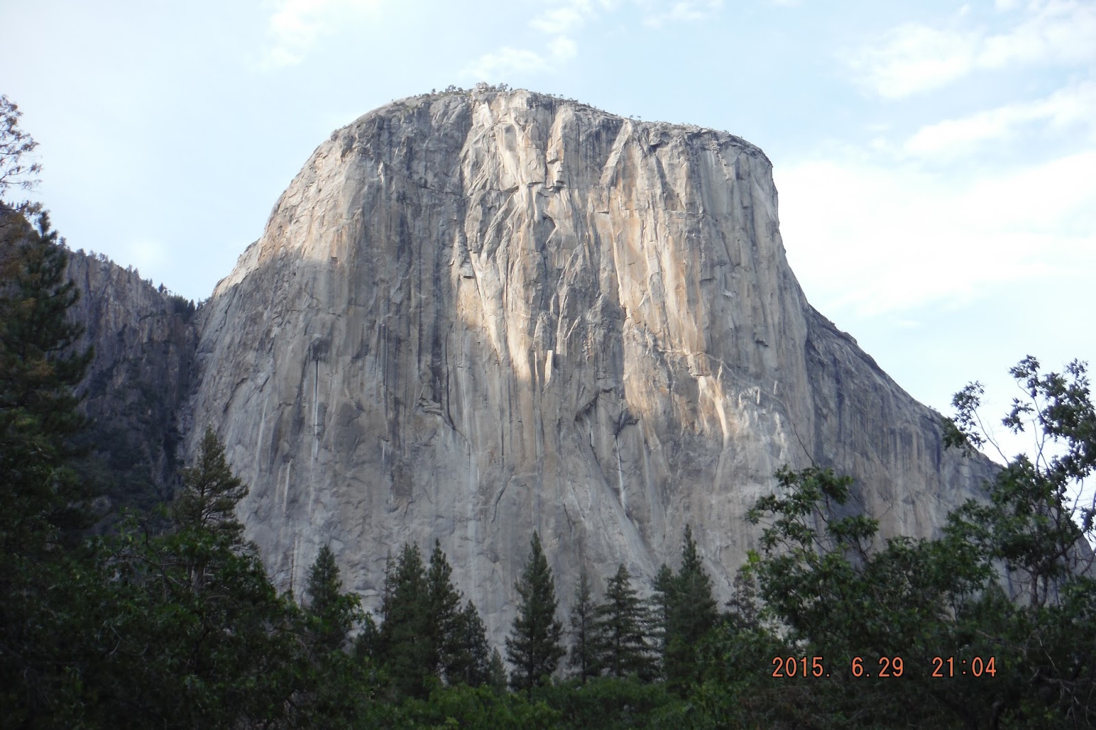
- Yosemite
- Mount St. Helens
- The coincidence of meeting Jim (and Mary) and how it helped solve the GPS issue and their generosity and hospitality
- Beartooth Pass: Fun as always
- Chief Jospeh Highway: Amazing views
- Tetons: Young mountains, beautiful lakes
- Idaho: Great canyon roads
- Mount Rainer: Majestic
- Mount St. Helen's: Unimaginable the power of the volcano to destroy a mountain
- Oregon/California Coast: Beautiful
- Crater Lake Oregon: Bluest water I have ever seen, cool looking into the mountain
- Sierra Nevada Mountains: Sonora Pass has great views
- Yosemite: Wonderful campsite
- Death Valley: Amazing colors
- Number of riding days:17
- Total miles: 8,418
- Average miles/day:488
- States Ridden In: 15 (Minnesota, South Dakota, Wyoming, Montana, Idaho, Oregon, Washington, California, Nevada, Arizona, Utah, Colorado, Kansas, Nebraska, Iowa)
- Total expenses: $1,425
- Average cost/day: $83.85
- 38% of expense on fuel: ($538)
- 30% of expense on lodging (camping/hotels): ($431)
- 2 nights in hotels
- 3 nights at family/friends
- 11 nights camping
- Gallons of fuel:171
- Average MPG: 49
- Best tank MPG: 58
- Worst tank MPG:41
That is all I have. Thanks for following along. I hope you enjoyed the adventure!